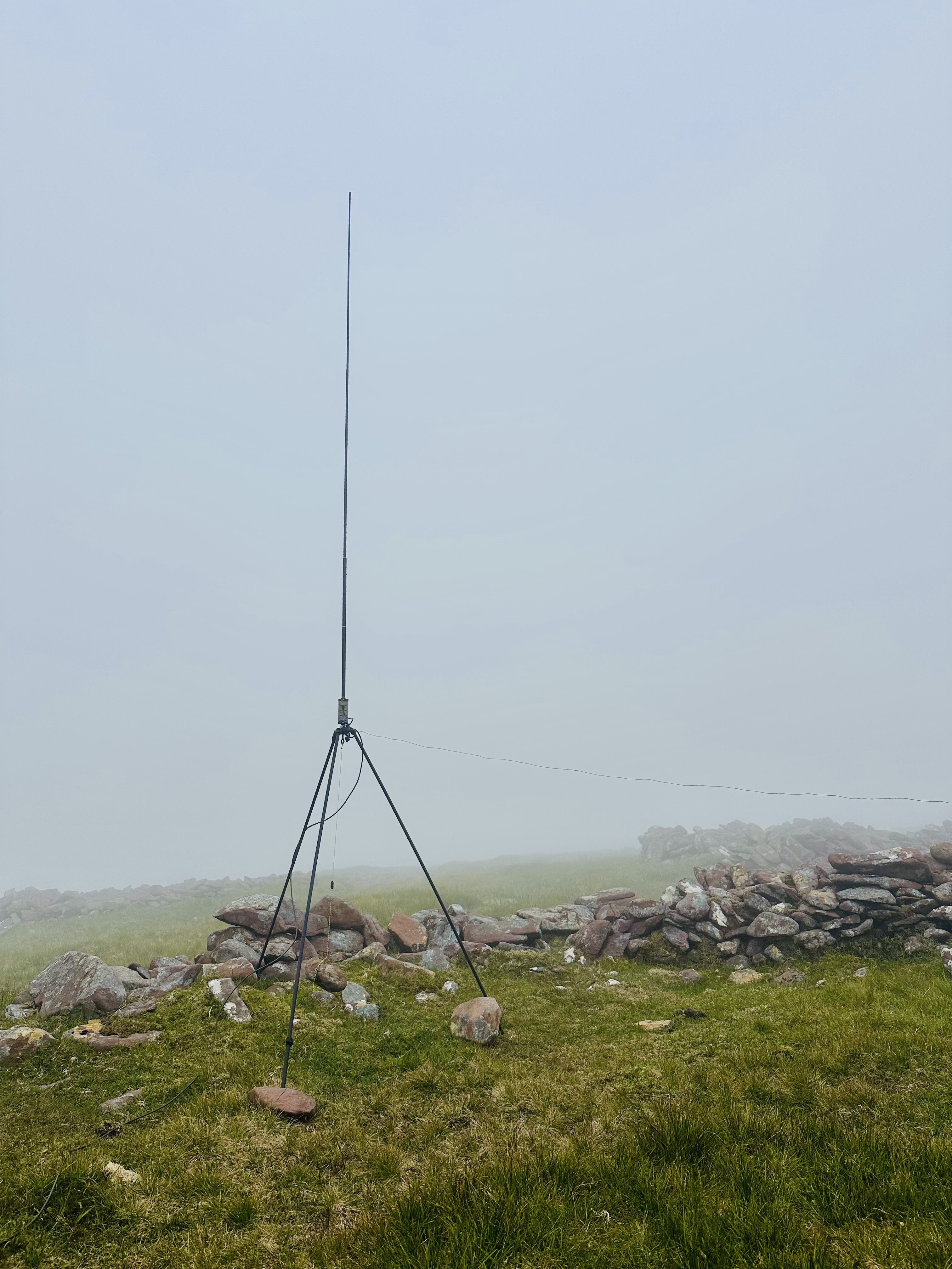
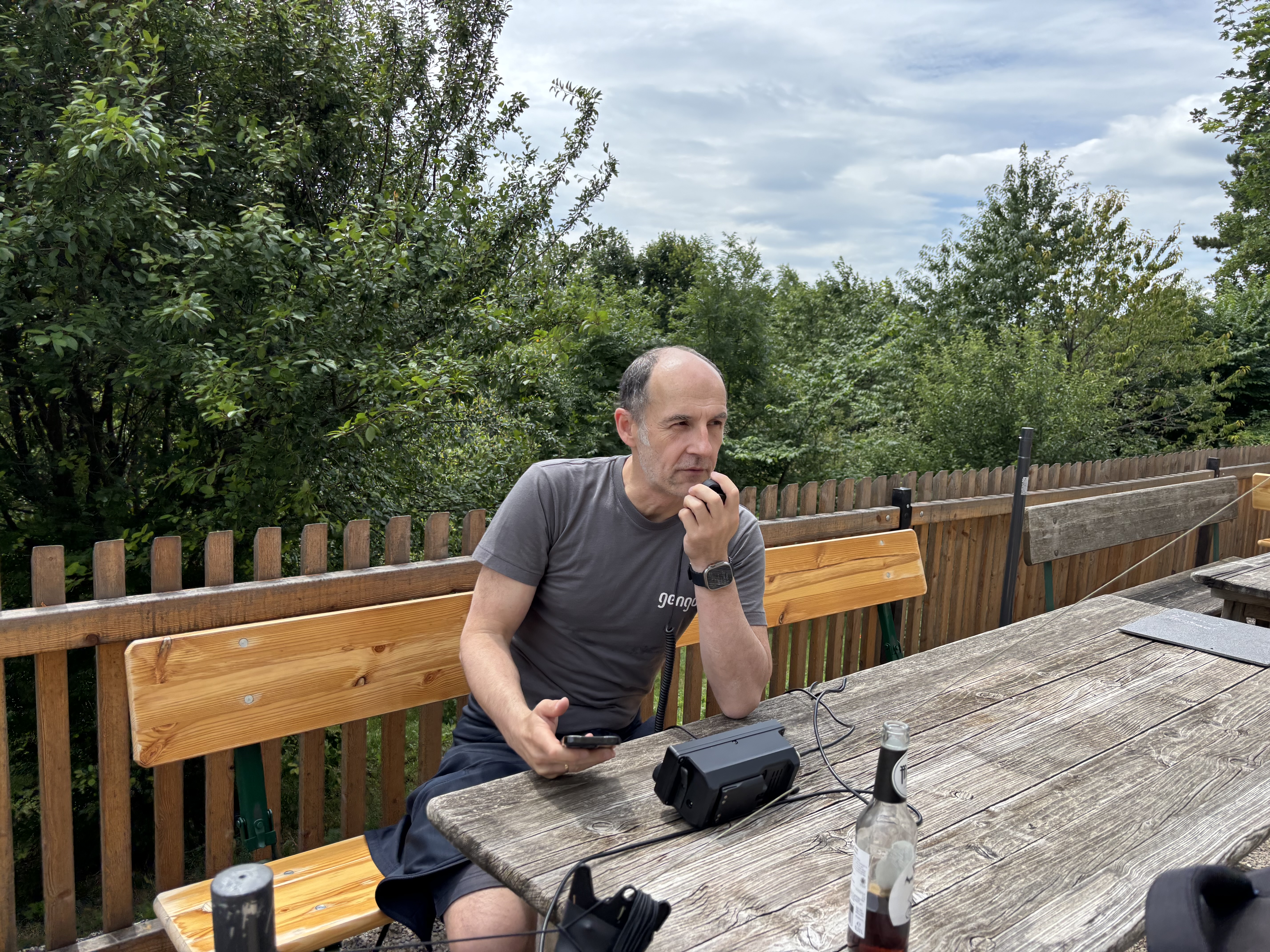
All set up for transmitting.
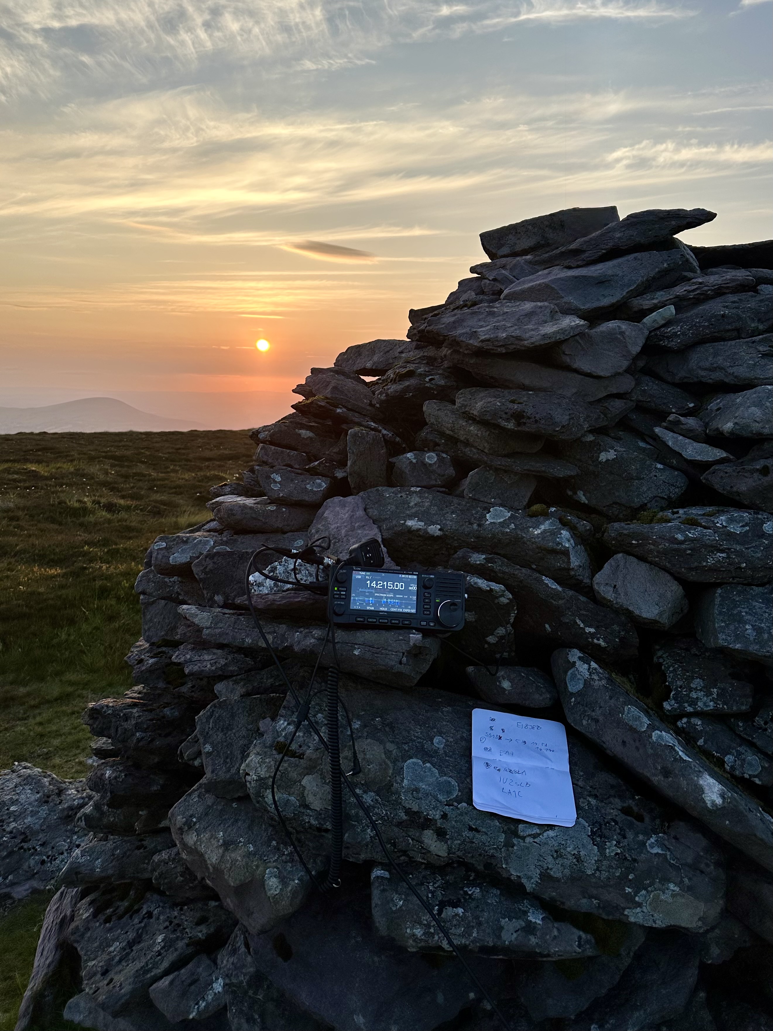
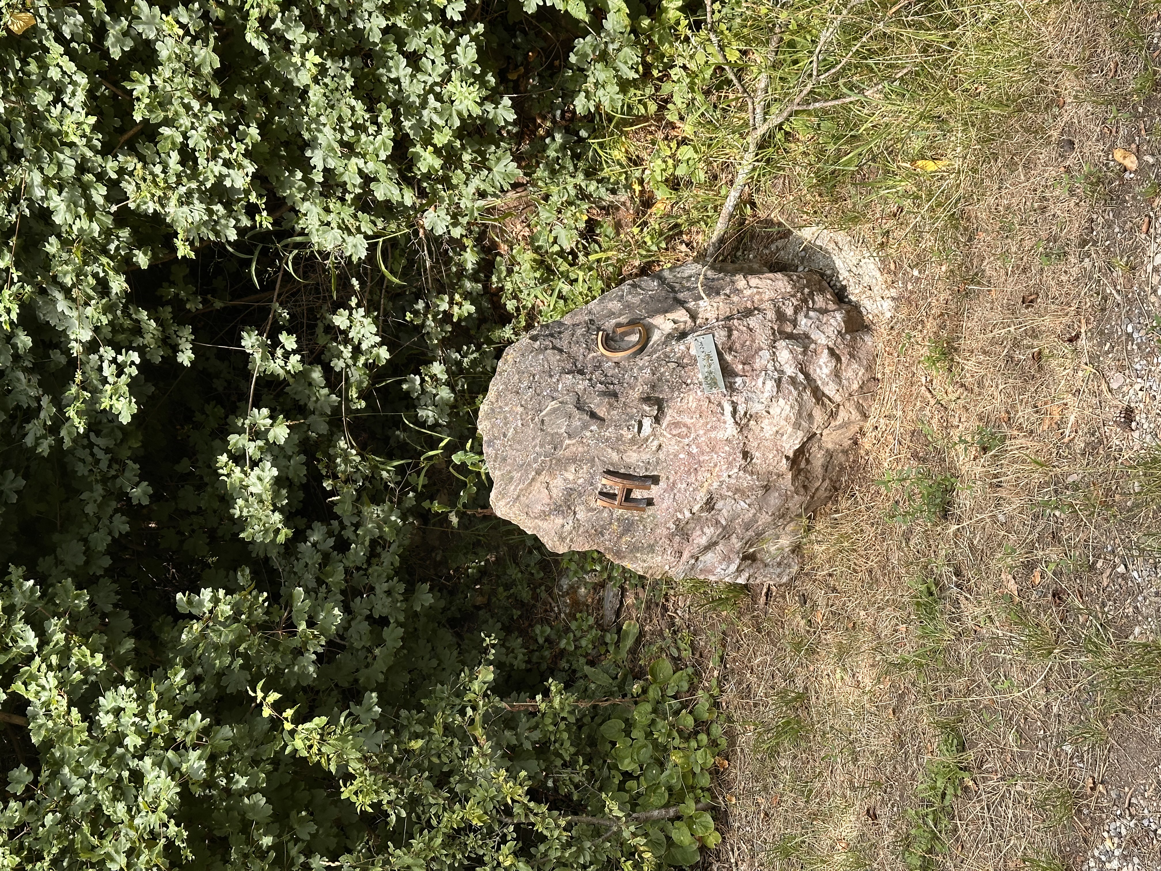
When my back got stiff, I put the radio on the cairn and continued operating standing up.
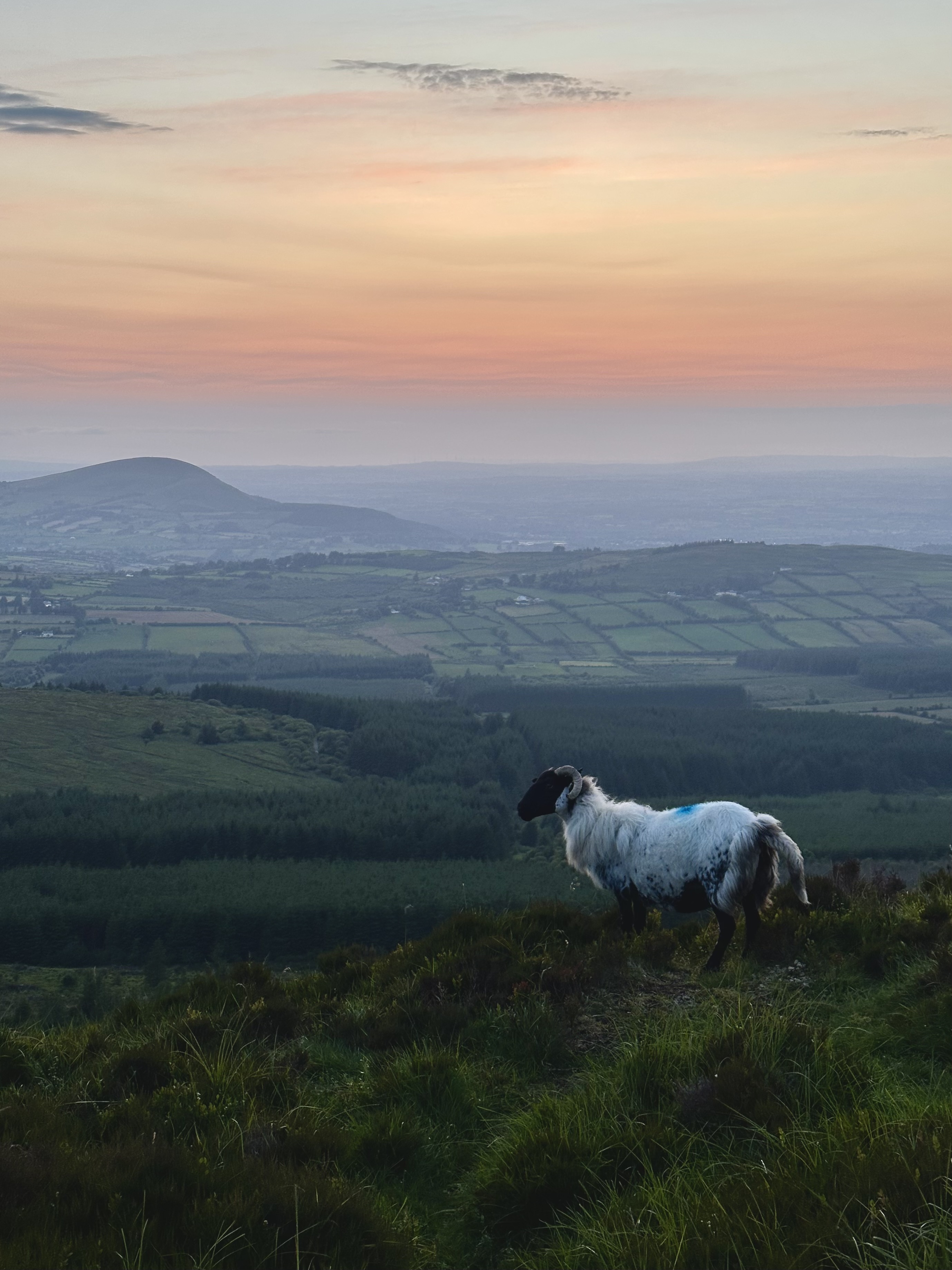
It had already been past sunset when I was walking down.
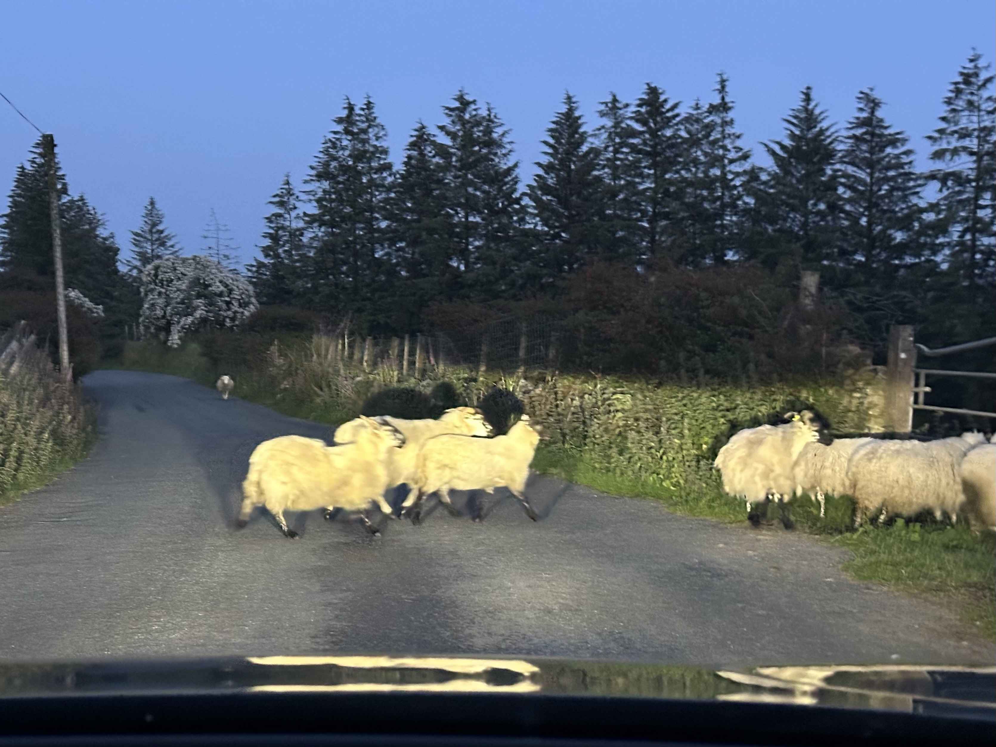
Sheep continued to be everywhere along my drive back home.
< Back to EI8JEB's radio notes
Almost immediately after I passed my amateur radio license test, I discovered the SOTA (Summits on the Air) program. The idea of challenging myself to win the highest reward, Mountain Goat, is appealing to me. I may want to attempt it. I need to keep activating peaks for the total of 1000 points which to my best estimates is going to take at least a decade. So here I'll be keeping my loose notes from the summits I activated.
If you prefer watching to reading, there is also a small YouTube channel "Goat On The Air" where I'll try and keep documenting each summit I climb for activation.
EI/IS-033
Points: 8
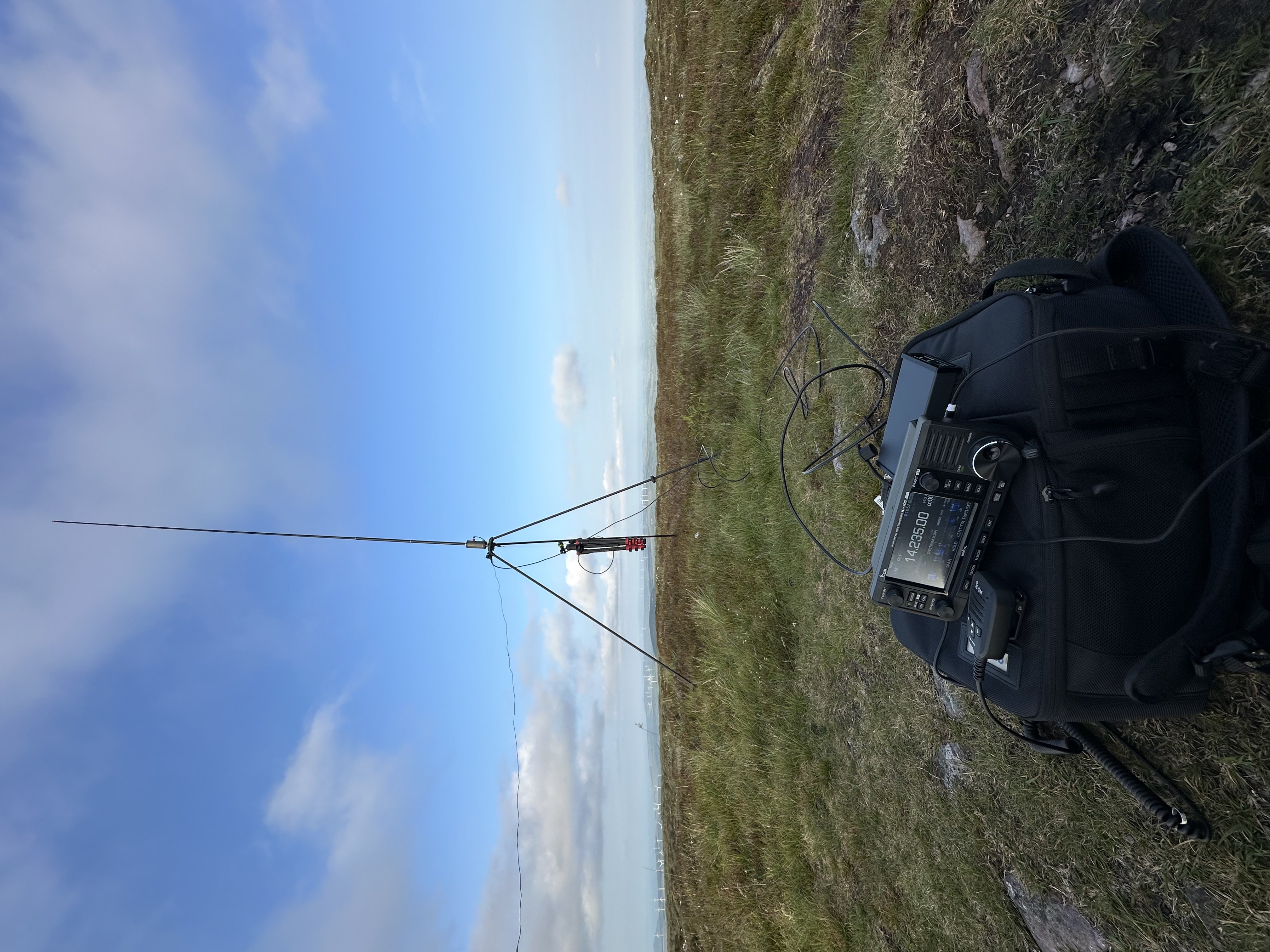
Antenna: BuddiStick PRO portable HF vertical
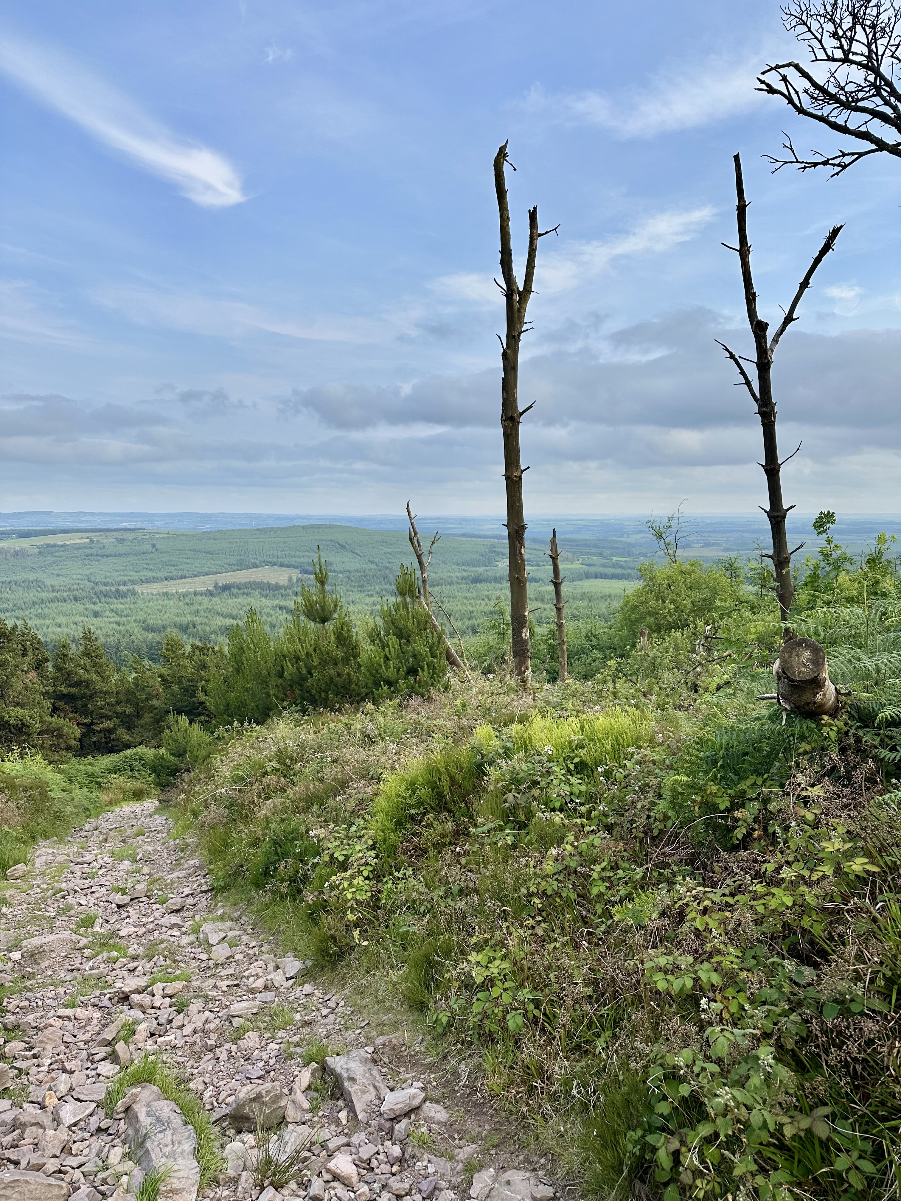
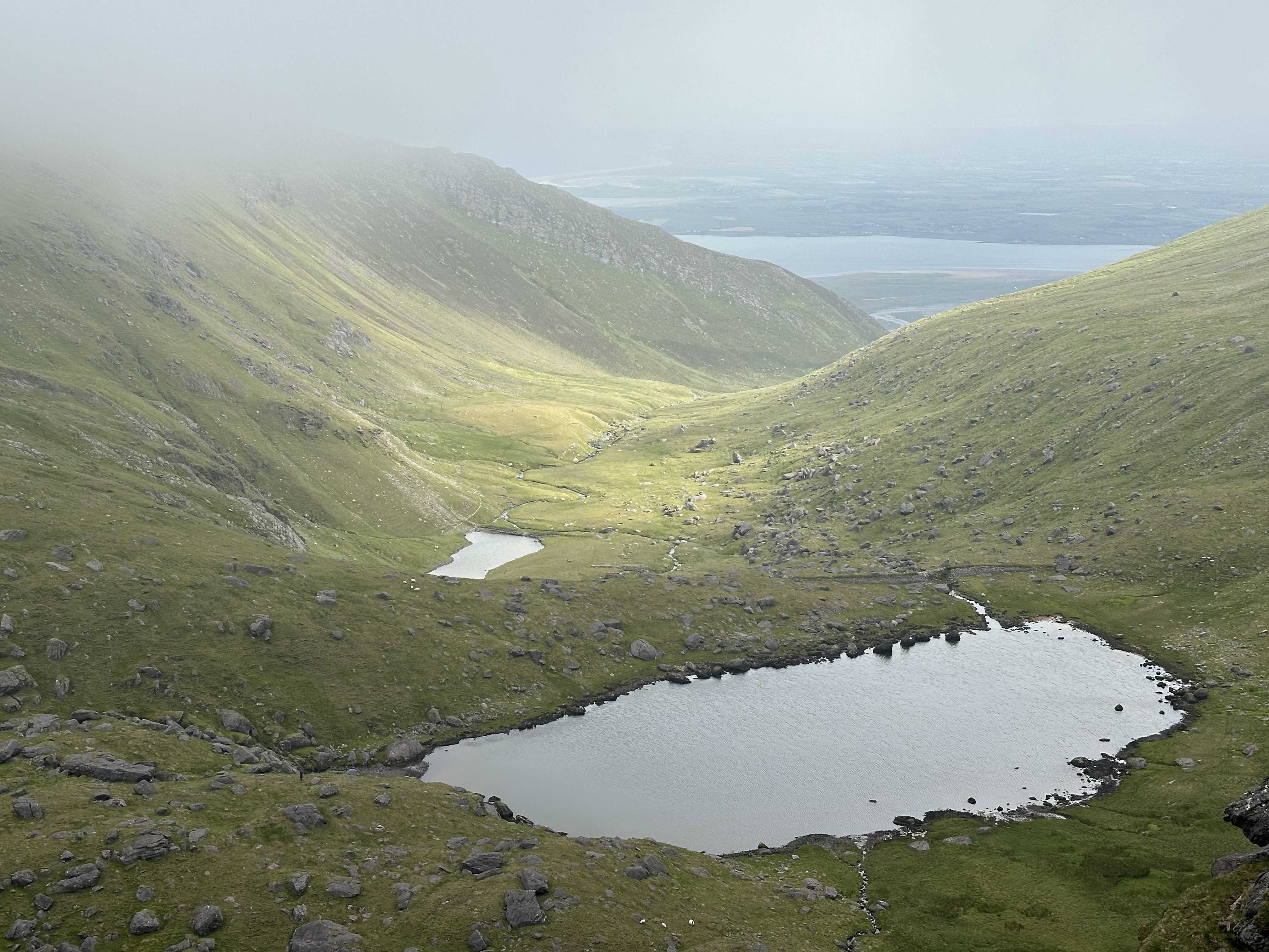
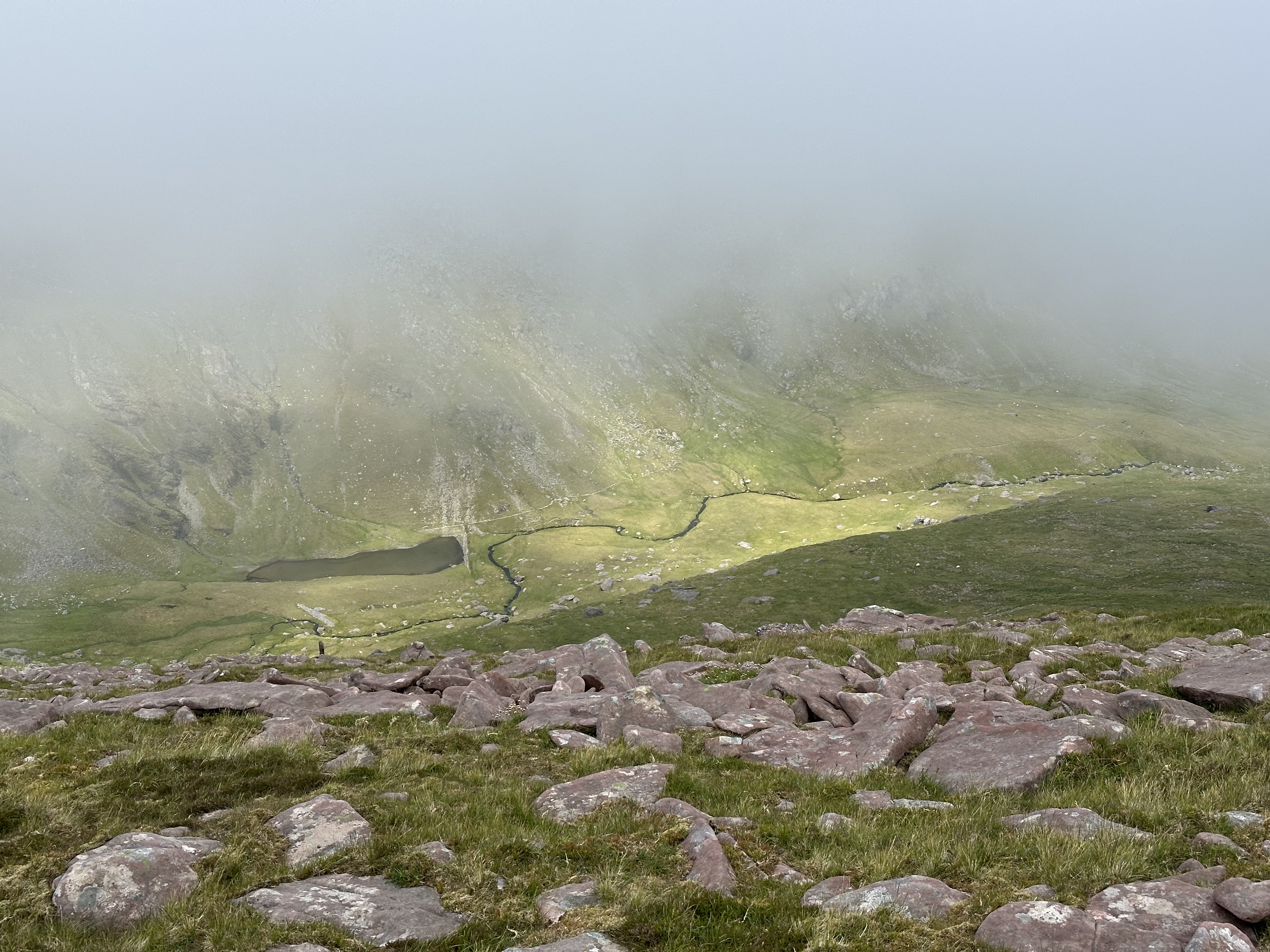
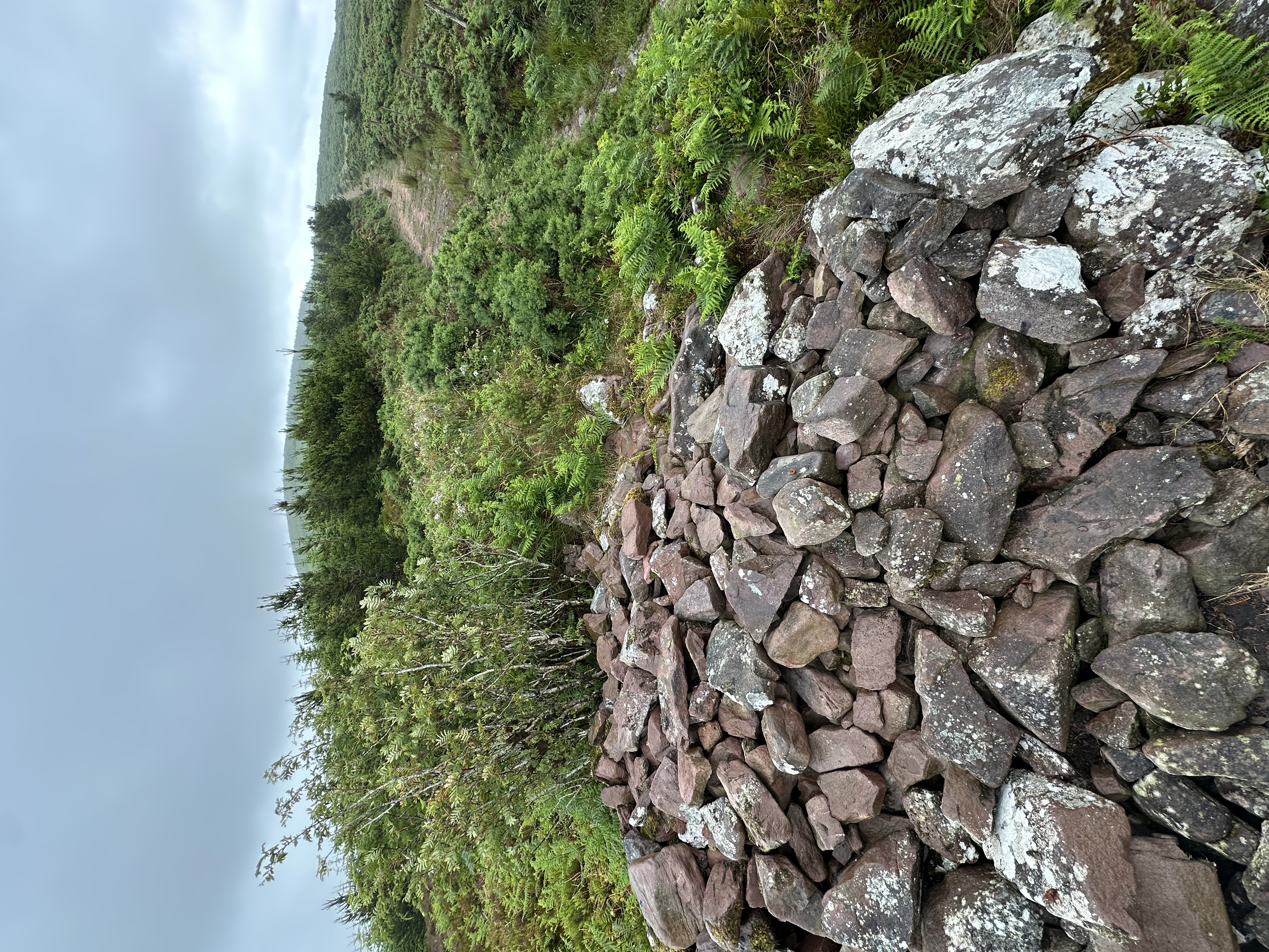
The trail is a straight line from the parking lot at 52.01173, -8.99523 all the way to the top. The climb is not difficult, but takes quite a lot of time. I think at least one hour. There are many friendly sheep along the way, and the views were beautiful in the evening. I set up my antenna and sat with the radio, leaning against a stone cairn close to the top. No trees anywhere on the summit, so it was a good idea to take the BuddiStick antenna on a tripod. I made a few contacts from there, and they were my first SOTA contacts ever. I stayed there until sunset, and didn't see anyone except for one person who looked like a farmer checking on his sheep.
EI/IS-068
Points: 4
Antenna: BuddiStick PRO portable HF vertical
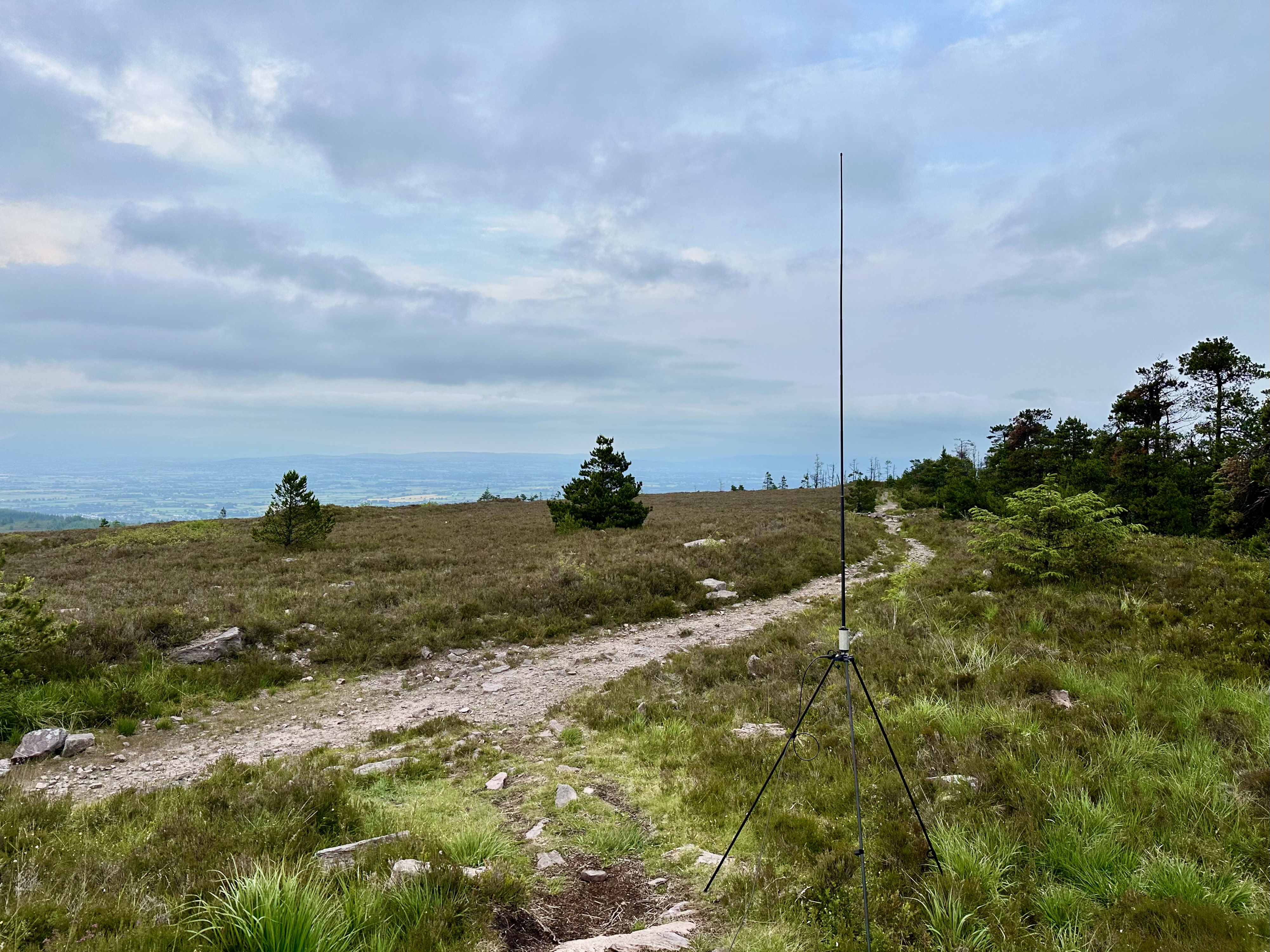
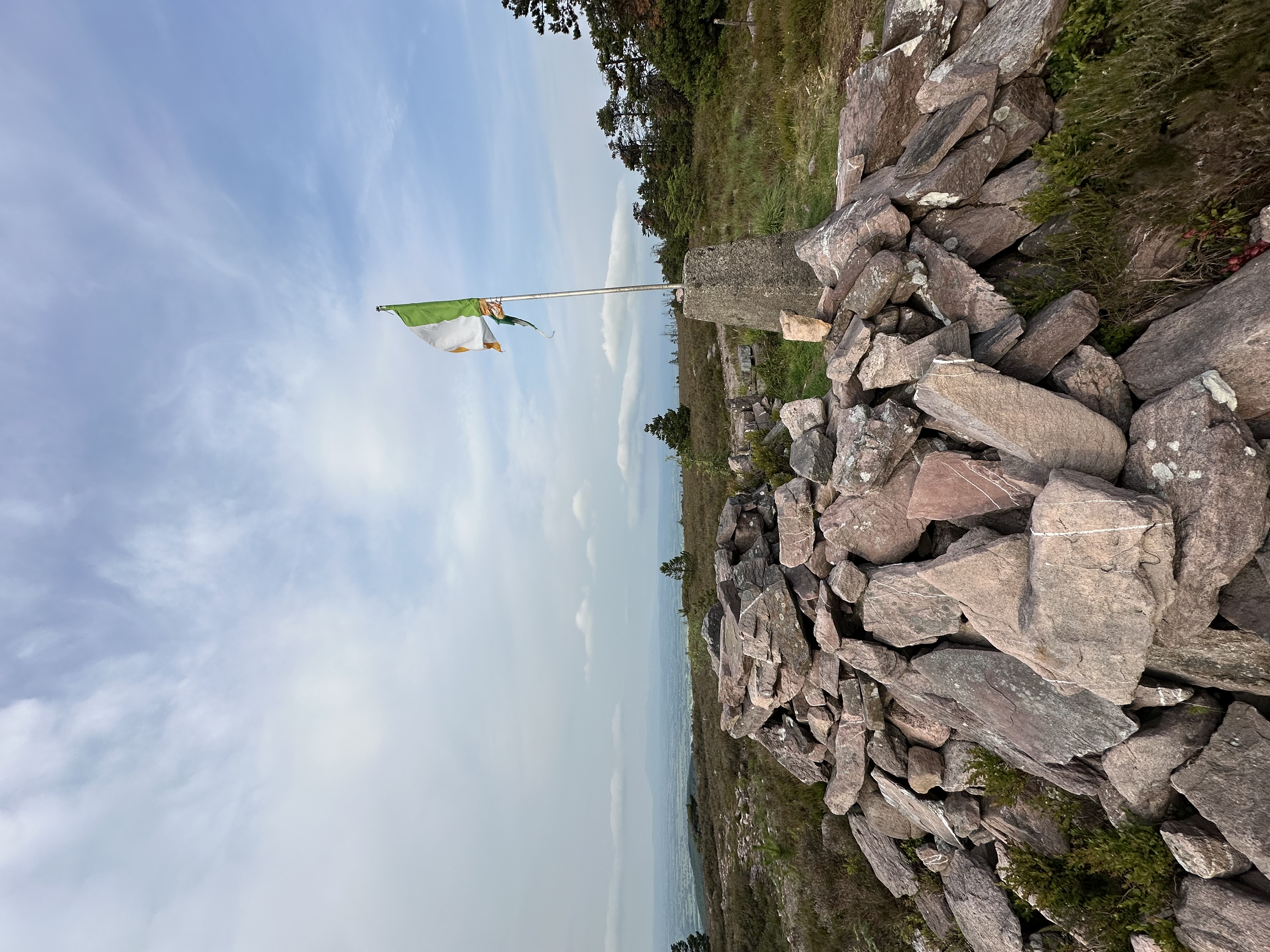
Easy climb, walk rather. One can park at 52.100070, -8.426540. People go there for afternoon hikes, and there is a shabby Irish flag stuck in a pile of stones at the top. No problems making contacts from the top, cellular connectivity is also there for logging etc.
EI/IS-005
Points: 10
Antenna: BuddiStick PRO portable HF vertical
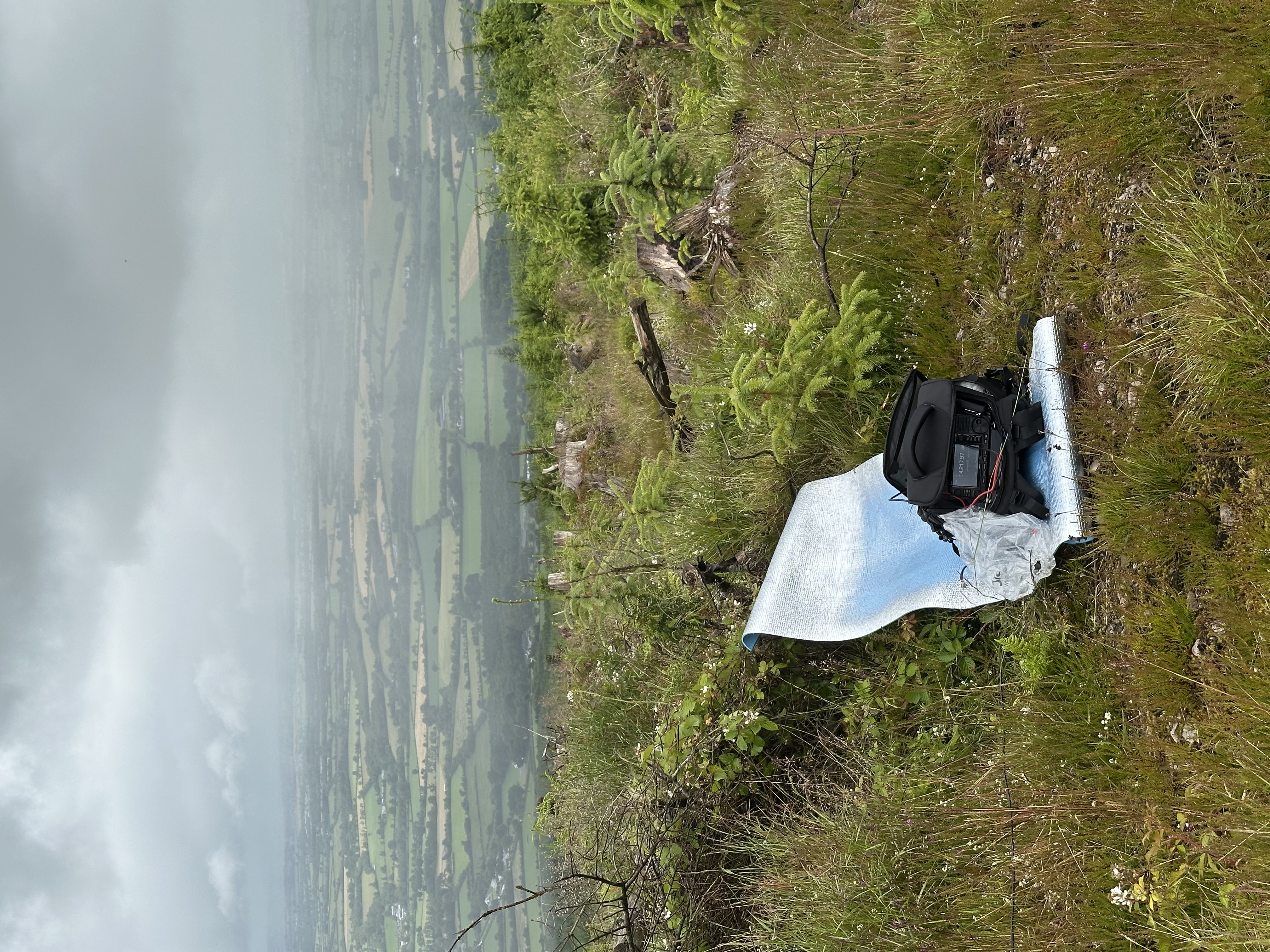
I parked at 52.234781, -9.841594, but it is not a great place to park. You leave your car by a narrow road, in a rather secluded area between two farmhouses. The peak is tougher than one might think when they google the images. First there is a long and tiring slow climb through ferns, then through the stony Derrymore River valley (just stick to the river's west bank, have the river within hearing distance), then walk around the 3 lakes on their west side. Only then the proper steeper climb starts towards the col between Baurtregaum and Caherconree, sometimes you need to use your hands to climb. Then from that pass the final flatter climb towards the Baurgregaum itself. I was walking that last part inside a cloud with very little visibility, using GPS to orient myself. There are a few stone circles at the top, I installed my antenna in one of them, and sat on a mat to do the transmission from the inside of the cold and moist cloud. I spotted myself on SOTAwatch and made contacts almost immediately. I hadn't been sparing my phone battery and then realized I could not use my powerbank because I took a wrong cable. Never make that mistake! I was lucky to have had my watch which tracked my trail -- I just followed the trail in reverse. Orientation on that mountain is not a problem... except when you're inside a cloud. I could see maybe up to 5 meters in any direction. I think the round trip was 5 hours or so, and sheep accompanied me everywhere.
EI/IS-077
Points: 2
Antenna: Chameleon LEFS 8010 EFHW portable antenna 80-10m
There is a parking place at 52.123378, -8.843501. A rather uninteresting hill with ugly cell towers at the top. Really nothing to add here except mid-hike up the hill there is a car wreck by the trail. How did it get there? No clue. What is worse I operated in rain and everything got soaked. Lesson for future: take an umbrella or something similar if there is any chance for rain, to protect the gear while operating. Myself I was protected with proper rain gear but got soaked anyway. Anyway seems like IC-705 doesn't have problems working while a little wet. On the positive side, I made my first contact with a US station from that hill! And on SSB no less! It could have been thanks to a different antenna I took this time: the end-fed Chameleon. I stretched it from a trunk of a dead tree, sloping down to ground level. Very close to the cell phone towers, exactly in this spot.
EI/NO-149
Points: 2
Height: 645 m
Antenna: Chameleon LEFS 8010 EFHW portable antenna 80-10m
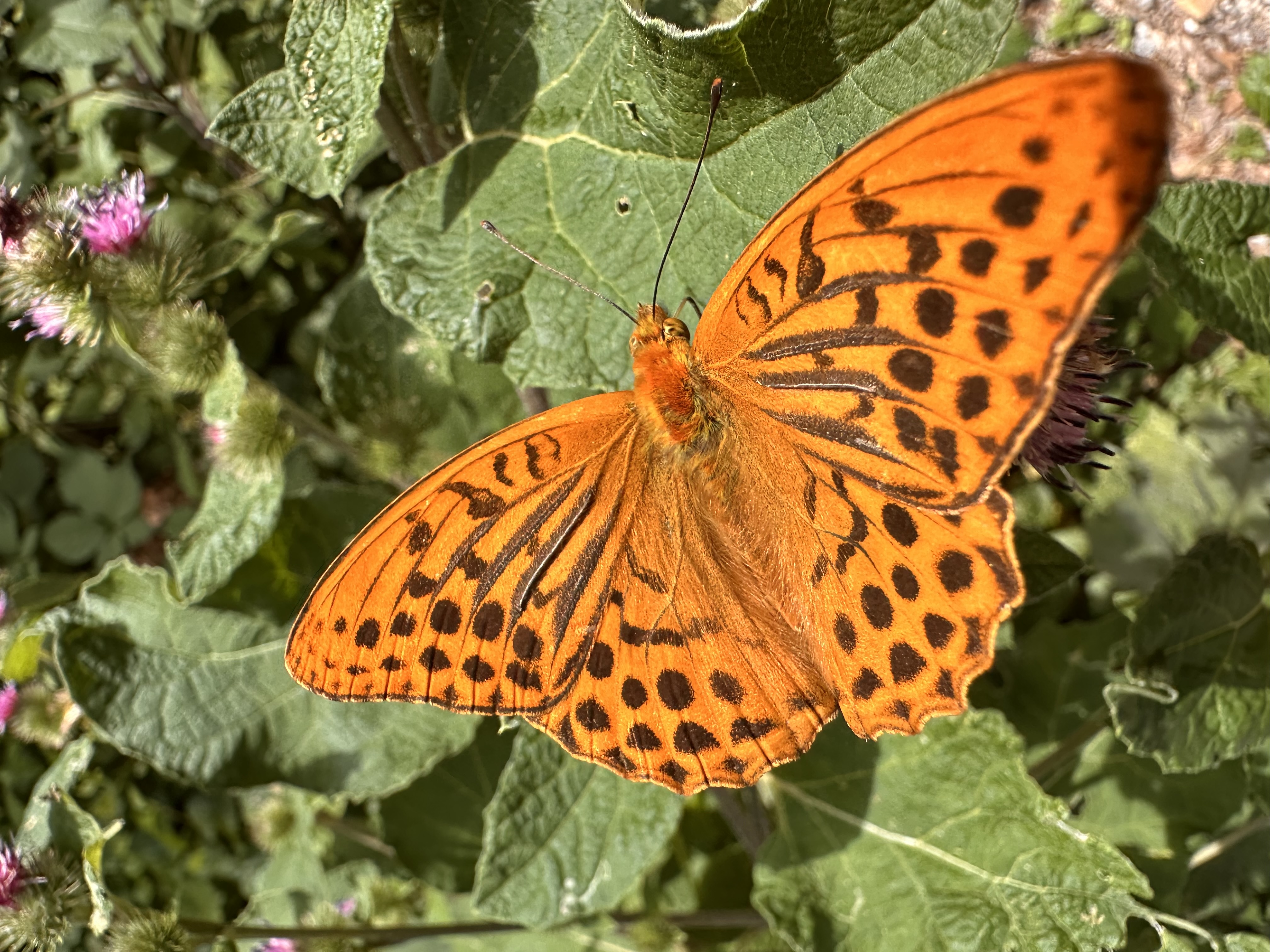
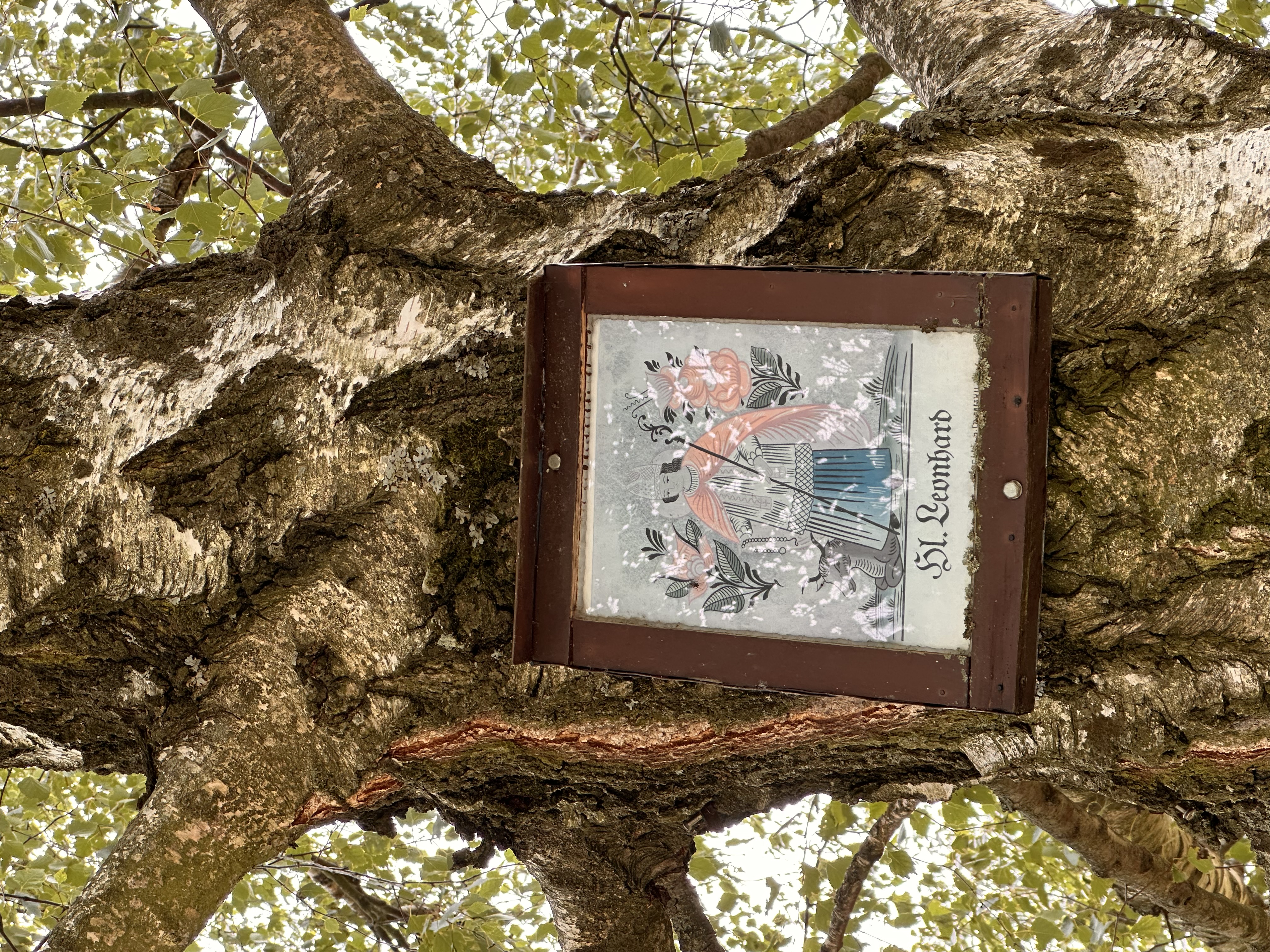
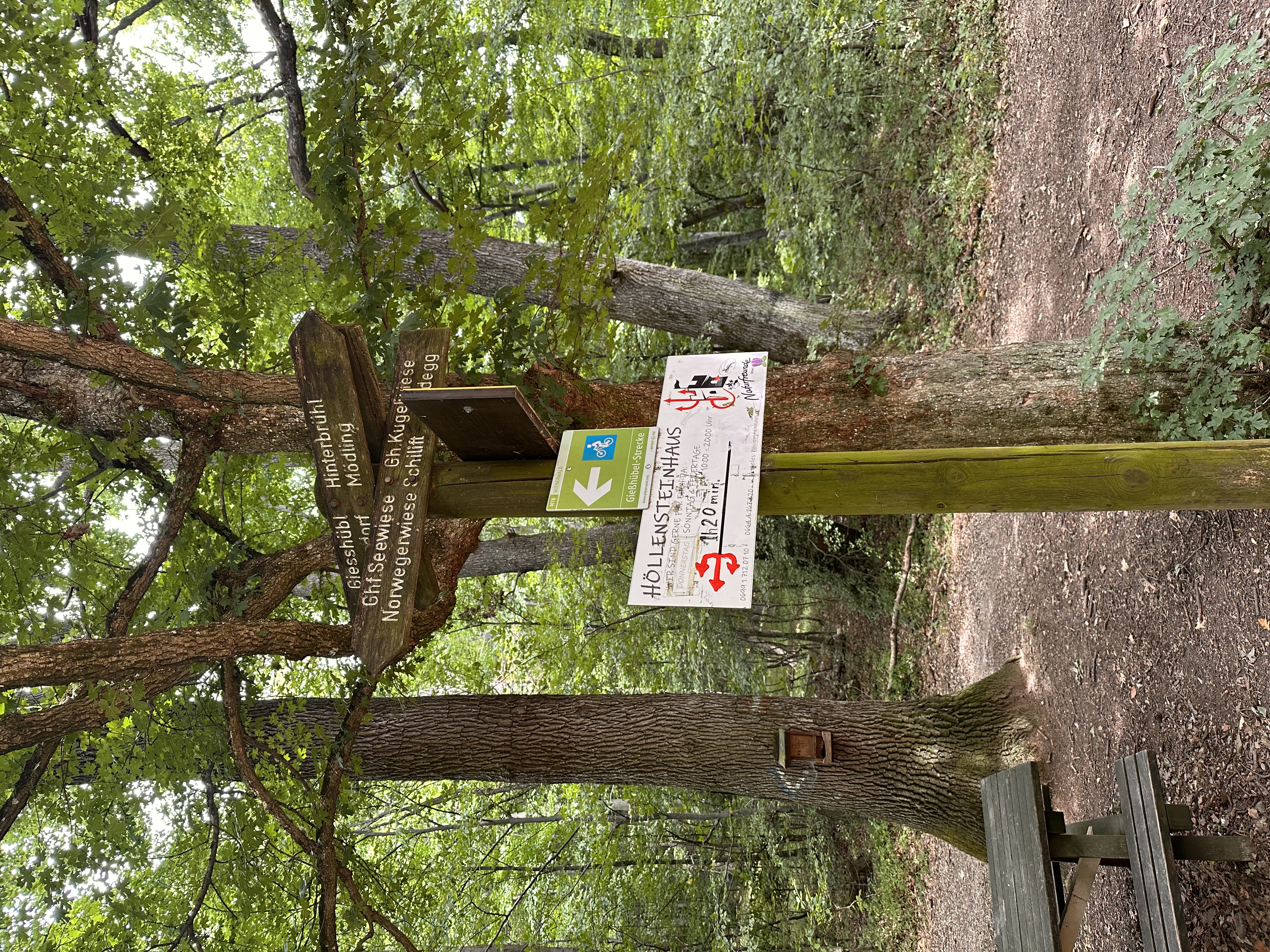
Family outing! We parked in Gießhübl at 48.099693, 16.226045 and walked for about 1 h 45 min. It is an easy walk, it gets slightly steeper only in the last 15 mins. Beautiful cornflowers (Polish bławatki!) on the way, and equally beautiful butterflies which the AI tells me are called silver-washed fritillaries. The mountain lodge on the top (48.096182, 16.187614) has a folly tower from which I dropped my end-fed antenna. It was a Wednesday and either there was nobody in the building or nobody showed up. Apparently they open to customers from Thursdays onto the weekend. We were still able to get cold drinks by grabbing them from a fridge in the hallway and leaving money in a small basket which was there for that purpose. I imagine that on a weekend there would be many more hikers there, and throwing an antenna off the tower would cause nuisance to others. But with nobody around I was able to stretch the wire to one of the tables and operate from there. HF bands seemed closed and I barely made one SSB contact with an operator in Barcelona. So I resorted to FT8 which does not require good SNR or strong signal. Bad band conditions might have also been caused by my wire running very close to the mountain lodge wall. Anyway, on FT8 I made a few more contacts easily, with France, Italy, Montenegro among others, so the activation was successful.
9A/DH-160
Points: 1
Height: 237 m
Antenna: Chameleon LEFS 8010 EFHW portable antenna 80-10m
I "climbed" this summit during family vacation on Šolta island. "Climbed" is in quotes, because it's a short walk rather than any kind of climb. Really a 5 min walk from the parking spot by the cemetery at 43.360832, 16.348920. The top is covered with dwarf medditerranean pine trees, stones, and bushes. There is also a cross restored in 1992 (the year Yugoslavia broke apart into individual states, including Croatia), and two telecom towers. Since it was July, it was very hot there already around 7 am when I reached the summit. I managed to throw the antenna over a low branch without scratching more than one leg against the many low, dry bushes. Then I sat in a shadow and had to cool down before doing any radio work. FT8 was successful and so was SSB on 40m. I quickly made several QSOs with Poland, Hungary, Germany, Slovenia, including one contact with someone doing Fauna and Flora (it was the first time I heard about that program). All in all, an easy 1 point, but the heat became unbearable around 9-ish.


EI/IS-011
Points: 10
Height: 792 m
Antenna: BuddiStick PRO portable HF vertical
Initially I planned to climb the mountain via a short and steep kath from 52.22196, -7.94140, but it had been raining all morning, and that path was covered with thick overgrowth, so I chose to use the long (but also steep) path from "The Vee", a picturesque mountain pass at 52.242255, -7.956065. That longer path involves first climbing Sugarloaf, and only then trekking towards Knockmealdown via a saddle; that latter trek is easy, the biggest difficulty is in the first stretch onto Sugarloaf. On the top, there is a concrete block of an OSI benchmark, and an old burial place of an eccentric who wanted to be buried there with his horse (or so I've read -- I could not locate the grave unless it was the heap of stones not far from OSI's marking block.


EI/IS-028
Points: 8
Height: 667 m
Antenna: BuddiStick PRO portable HF vertical
The activation was successful, but the hike turned out to be strenuous, and totally thanks to myself... I hiked from Knockmealdown which I activated on the same day, and after walking through countless peat bogs, I reached Knocknafallia whose top is pretty flat, and where one can shelter from the wind in a round cairn. That's where I set up my antenna and did the activation. Self-inflicted problems started later, because it seemed too boring to hike back using the same route, and I improvised my own way down from the hill. Instead of going north-east to where I came from, I went south, and it all went south from there. Not only did that decision cost me a long descent over unmarked trail, often through bogs and tall grass, but also resulted in me finally meeting the paved road as at 52.194455, -7.899266 which was far from where I parked! To reach my park, I practically had to go around the entire south-west of Knockmealdown mountain range. I tried to hitchhike but nobody stopped for a weird-looking person with antenna poles protruding from the backpack, all dressed in green. It was evening when I reached my car, and I did close to 22km on that day, and you know very well that 22km on flat surface does not equal 22km in the mountains. I was totally exhausted.


EI/IS-003
Points: 10
Height: 952 m
Antenna: BuddiStick PRO portable HF vertical
From the parking lot at 52.2147782, -10.2921590 the trail is very clearly marked. What is more, the trail is at the same time the Way of the Cross with fourteen stations (the crosses are even marked and numbered in OpenStreetMap!), so the entire climbing is a matter of going from cross to cross, with the largest one on the summit. GSM coverage is good on the top. After climbing from the west, there is a dramatic and dangerous cliff on the eastern side, so careful there. Throughout my entire hike and at the top I was in a cloud, so I could not see the precepice in front of me when I operated the radio... but I knew it was there, and the feeling was uneasy. The activation was difficult as it was very windy, moist, and cold. I spent there a lot of time before anyone answered my call, and when they finally did answer, it was four stations one after another. I was all tired and wet when I started walking towards the second summit of the day, confusingly named Brandon Peak.


EI/IS-007
Points: 10
Height: 840 m
Antenna: BuddiStick PRO portable HF vertical
From Brandon Mountain I continued my hike to Brandon Peak. Almost all of it, including activation itself, in dense cloud. Only occasionally did I see the precarious cliffs on the eastern side (to my left). Activation-wise things were good, I made 8 contacts, but as far as hike enjoyment goes, it was very limited because I could not see further than a few meters. At least it wasn't as wet on Brandon Peak as it was on Brandon Mountain.


EI/IS-015
Points: 10
Height: 773 m
Antenna: Improvised antenna made of the counterpoise wire (due to the main antenna being unusable)
The plan was to hike the entire Mullaghanattin Horseshoe walk, i.e. start from the parking spot by the junction at 51.910715, -9.821005, walk around the entire valley colloquially known as The Pocket, activating both Mullaghanattin and Beann, and come back to the car from the other side. The plan worked only partially, and that's due to the fact that I lost half of my Buddipole antenna somewhere on the way. It must have disengaged from my backpack, and I realized that it was missing only after reaching the first summit, Mullaghanattin. I was exhausted and disappointed, and I was sure I wouldn't have been able to activate the summit. The 2- or 3-hour hike seemed in vain. But then I rested a little, started breathing, and started thinking about the items I had with me which could potentially have been used as an improvised antenna. I ended up using the Buddypole's counterpoise wire as the active element, stretching it a few feet above ground, and connecting to the trig benchmark on one side, and directly to the tuner (with no feed cable) in my backpack on the other. Mechanically the whole structure was very feeble; I had to somehow structurally ensure that the tiny wire does not slip out of the BNC center hole, and yet is tensioned and withstands very strong gusts of wind that were there at the top of Mullaghanattin. I did not connect anything to the BNC's ground. With this extremely primitive antenna I was able to make 6 contacts, including with people doing lighthouses on the air in Normandy! How cool is that! However, because all this took me a lot of time, and I was exhausted, I did not go to activate Beann. Activating Mullaghanattin with this ad-hoc antenna was a huge success for me already. Instead of doing the horseshoe, I went back the same way. Also, this is the first SOTA activation on which I took my DSLR; it added a lot of weight, but allowed me to take much better pictures of some of the fabulous views there are on that trail.


EI/IS-006
Points: 10 (total points: 85)
Antenna: Chameleon LEFS 8010 EFHW portable antenna 80-10m
The hike from the parking place at 52.006822, -9.480356 is not a difficult one, and the trail is obvious with no risk of losing your way even in mist. There is a lot of fern, tall heather and gorse along the first part of the trail, but the path itself is not overgrown. If anything, one nuisance is the millions of tiny, biting flies, but these are fewer and fewer as one progresses further up the hill and away from the small Finoulagh river. Regarding fauna, the area is a natural habitat for two spiecies of deer, the red deer and sika deer. Two of the sika deer followed me soon after I set off, and I was able to take a snap with my DSLR. Later I learnt from an acquiantance in Killarney that they are pretty common there, and are not much afraid of people.
The well-defined trail is punctuated with cairns and shapes made of stones. I was there early, and I walked the entire trail without meeting a single person.
The sky was overcast and Mangerton was hiding in one big cloud. I had already come to terms with the fact that I'd be activating the summit inside a cloud, and I had done that before. I was fine with the lack of visibility, but wasn't looking forward to all the moisture on my radio and everything else. The weather wasn't improving as I was climbing. When I reached Devil's Punchbowl, it didn't look at all the gorgeous way Google had shown me when I was researching the hike -- it was grey and dull.
The last part of the hike, from Devil's Punchbowl to the summit, is the steepest, but I wasn't bothered by that. What bothered me were the peat hags on the summit. Mangerton's top is a large flat area, and peat hags from the Devil's Punchbowl side succesfully prevent people from actually reaching the summit: most hikers content themselves with the view from the trail onto the lakes and Killarney, and then continue around Devil's Punchbowl. I, however, did want to reach the summit, so I first ventured onto the grassy area through the peats, but backed off quickly after the ground got softer and softer. Then, back from the trail, I walked further along the ridge and around that boggy area, on slightly drier grass and stone. Again there was a lot of grass closer to summit, but ultimately I made it. If it wasn't for the trig benchmark, I wouldn't have known where the summit was.
The trig point has an old and rusty vertical pipe attached to it. I don't know the original purpose of that pipe, but several earlier activators suggested using it as an antenna mast. That was my plan, but it didn't work, as it was too windy. I was unable to toss a rope over the bent part of the pipe, or to loop it using my lightweight sticks from my (now broken) Buddystick antenna. So I ended up stuffing the sticks into the opening in the trig point, and attaching my EFHW antenna to this improvised mast. The other side of the antenna was attached to a stone on the ground. It didn't look great, and it was not set up as this antenna was supposed to be set up, but it worked. The moment I turned the radio on and heard very clear transmissions from others I knew mine would have been heard too. And indeed I made several contacts pretty fast. After several summit activations I am starting to notice that it is usually roughly the same group of chasers that find me... I'm starting to feel at home the moment I hear their call signs!
As I was working the stations, the weather started improving and even sun came out! Since I was on top of a mountain, the clouds were being blown onto the peak and down from it, and it made for a very dramatic spectacle. I had something to eat and felt great watching it! Then the weather improved even more, and I was finally able to admire all the views Google was telling me about on my way back.


EI/IS-020
Points: 10 (total points: 95)
Antenna: Chameleon LEFS 8010 EFHW portable antenna 80-10m
Some say driving on Priest's Leap pass is dangerous, but it isn't. One needs to pay attention, because the road is narrow and may require reversing to allow opposite traffic to pass, but there's no danger. The steepness, ups and downs, steep turns, and expansive views into the valley may create the illusion of somewhat of roller coaster-like ride, but the car is in no danger of accident at any point, at least no more than on any narrow road. I was there early morning and the biggest obstacle for me were the dozens of sheep I woke up from their slumber in the middle of the road.
The parking spot is close to the high point of the pass, at 51.793446, -9.471237. There is a stone there with an inscription commemorating the legend of a giant leap a certain priest running from hunters made on his horse from here. Apparently he reached as far as Bantry with that single leap.
To start the hike, one needs to walk over a stile. Then I just stuck to the fence until it turned sharply left. At that point I went north-east to reach the Lough Boy and cross the little stream at 51.796729, -9.460481. From there I climbed along the fence again and reach the summit before I wsa even properly warmed up. It is quite a short and straightforward hike really for 10 points, mostly because of the high elevation of the starting point at Priest's Leap. The entire hike up, and the entire time I was on the summit, I was in thick mist.
Knockboy is geographically interesting because it sits at the border between County Cork and County Kerry. Interestingly, it is also the highest point of County Cork. The views from the peak are supposed to be marvellous, but I did not get to experience them -- again today I was operating inside of a cloud.
The radio work was uneventful and I made several QSOs quickly, upping my total points to 95. I was working with my EFHW suspended between a fence and... a mast with a Meshtastic router on it. Yes, radio people were there, and installed a permanent mast with a LoRA device on it. The solar-powered meshtastic router must be acting as a repeater between two or more Meshtastic stations. I need to find out who installed it and how successful they were with the project, especially range-wise! Additionally I noticed a SOTA sticker on the mast. So the meshtastic router might have been installed by SOTA people. Interesting.
On the way back the sky cleared a little, and also I walked out of the cloud above me. I could finally see the Bantry bay and the surrounding mountains. All in all, a rather uneventful activation, with the only surprise being the LoRA equipment found on the top.


EI/IS-004 and EI/IS-010
Points: 20 (total points: 115)
Antenna: Chameleon LEFS 8010 EFHW portable antenna 80-10m on SOTABeams mast
The parking spot at 52.335231, -8.157424 is good for three or four cars maximum, but I was early, and it was Thursday, so there was no competition. It was only after I had changed to my hiking gear when the second car arrived. The man was both much older than me and much more fit, and a fast walker to that. He quickly caught up with me on the trail. We exchanged a few words and he paced on.
It was still before sunrise when I reached the stone which commemorates the airplane crash of 1976 which killed the crew of three. Some distance further, the rubblestone trail forks at a large cairn. Most hikers take the right there and climb Galtybeg first, then head west to Galtymore. I wasn't interested in Galtybeg, so I took the less frequented left turn to head straight onto Galtymore. After meandering between some peat hags the trail, which had been unambiguously clear thus far, became almost non-existent, and I followed my nose (and the AllTrails app). All the way to the saddle between Galtybeg and Galtymore, where the views onto the northern side of the Galtees open. I was in no position to admire the dramatic landscape though, as I was focused on keeping balance. That's how strong the wind had become! At that point I knew activation will not be easy or comfortable.
When I reached the 918-meter summit, the wind was horrific, and the visibility was close to none. It was moist but not raining per se, so at least that helped. It was the first time I used my new SOTABeams mast, purchased following recommendations from the more experienced folks at the SOTA Reflector forum. I guyed it with three lines, and amazingly it was able to withstand the crazy gusts. I sat with my Elecraft KX2 (another first on this hike), spotted myself, and easily made 12 contacts. Really it was only thanks to the stony shelter that I could hear anyone at all. After disassembling the antenna and mast, I quickly run down without even reaching that cross which I know is further to the west of Galtymore. It was just too unwelcoming up there.
Back at the cairn where the stony path bifurcated earlier, I assesed my energy levels, and decided to go and climb Greenane too despite the lousy weather on higher elevations. Going back to the bifurcation was deliberate — had I just walked along the ridge, as the "Galtee Challenge" hikers do, I would have had to deal with much larger elevation differences. My goal was to successfully activate two specific summits, and not to stick to the ridge trail.
It was a good decision, because Greenane, despite beling lower than Galtymore, proved to be more difficult to reach. The peat hags there were killing me. Don't get me wrong, I love their dramatic look, and their palette with the pitch black undersides, but to say they are a nuisance on the trail is an understatement. Does anyone have any tips for how to deal with them? I always think I'm heading for the easiest spot to descend from them, and it always turns out to be a 2- or 3-meter drop, and I need to go back and try again elsewhere. Or I find myself next to a black muddy slide, and I don't know how hard the surface is, so either I go back again, or I risk and step onto it and fall into peat. This time I fell knee deep at one point. Not only did I look disgusting (as if there were any watchers... there were none), my leg was also wet and cold. Love and hate those peat hags.
The O'Loughman's Castle, on the way between Galtymore and Greenane, is not really a castle, but it looks like one. This odd rock formation looked spooky like hell in the fog. Later I learnt that it was actually somewhere close to it where that airplane crash happened. I trudged on, made it to Greenane, and activated it with just barely over the minimum 4 contacts. It wasn't pleasant there at all; the wind was less strong than on Galtymore, but there was no cairn to shelter in. Just the trig point and some stones on which I did the activation.
On my walk back I realized lost my GoPro camera with the selfie stick. I had already lost my microphone somewhat earlier. I had given up on that microphone as it was too small to even attempt finding, but I didn't want to give up on the GoPro. I had already made it to Greenane West, a neighboring summit, and now I had to retrace my steps back towards Greenane proper. It would have set me back an hour or so, but I guessed I must have dropped the camera when I fell into the peaty bog, so I had a good hunch on where to look for it. And yes, it was there in mud. Good! Finally I could head back towards my car. I stopped halfway down, where the wind was not as strong anymore, and flew my drone to videotape some of the Galtee's beauty. I color-graded these recordings and they can be found towards the end of the YouTube video embedded here. They don't look bad at all for the small drone I was using. Overall, I was elevated and happy despite losing my micrphone and being covered in mud knee high -- in the end, I activated two summits in one day, and scored 20 points!


EI/IS-021
Points: 8 (total points: 123)
Antenna: Chameleon LEFS 8010 EFHW portable antenna 80-10m on SOTABeams mast
This was supposed to be a relaxing afternoon hike in the beautiful surroundings of the breast-like shape of the Paps mountains, with me immersed in the ancient Irish legends and contemplating the rituals of pre-Christian peoples. It ended up as the worst climb and descent I've experienced in SOTA activations so far, with me exhausted and soaking wet when I finally got back to my car...
The gravel road of the Slyggudal Pass is driveable, but not really meant for normal traffic. Technically at least parts of the route -- reportedly long time ago called locally the "Old Birdle Path" -- were declared public road in the 70s, but the road is very narrow and there are several cattle barriers along the way. When I drove from the southern side, all of them were open until the one at 52.01241, -9.24864 where I parked. There was a "No parking, private property" sign on the right side of the road, but there was some space on the left side too which I used. The area looked like a spot where farmers would turn their tractors so my guess is the "No parking" sign was to prevent cars obstructing the space on days when more visitors exploring the Slyggudal pass would be expected. But the drizzly Monday bank holiday afternooon wasn't one of these. There were no other climbers or hikers around. There was one farmer in long green raincoat chasing his sheep, and we exchanged greetings. Later, when looking down from the slope, I saw an occasional tractor or pickup track passing through the spot, with farmers opening the gates and then closing it behind them, and I could hear the voices of shepherds calling as I was climbing, but there were no other interactions. In general, the Slyggudal Pass road should not be considered driveable; if you are planning your Paps climb from there, plan on parking at 52.00208, -9.24600 and adding 15 mins of walk to avoid potential clashes with farmers or finding yourself trapped by a locked gate.
Coming back to the parking spot at 52.01241, -9.24864, there is a fence running west and up the hill. AllTrails suggest a trail on the right (north) of the fence, and you should probably follow it. I made a mistake of backing off from that trail because it seemed impossible to walk -- it is just a steep ground covered with thick heather. I should have continued up that difficult initial part, but instead I came back to where I started and followed the rubble stone path on the left (south) side of the fence. Which led me nowhere and I had to cross another fence and ended up on that same indiscernible heathery trail I backed off from. Arrrgh. By the time I saw my first false summit, I was tired and wet.
I made it to the top in wind, drizzle and cold. My plan was to record myself talking about the pre-Christian and even pre-Celtic, mystical significance of Dá Chích Anann, and their connection to the Beltane rituals and to the nearby "City" Cathair Crobh Dearg, take many drone shots of the Paps to add to the Wikipedia article I recently worked on, but none of these ideas materialized. I was soaking and miserable, so my only goal at that point was to activate the Paps East and find myself back in my car as soon as possible. At least the activation was very successful! I spotted myself, the GSM coverage is excellent up there, and started on 20m. It was OK, I made a few contacts, but then followed the advice of my fellow Irish SOTA activators and switched to 40m — and it was fabulous! Many contacts, strong signal with very high audio quality! I haven't heard people so clearly on HF since I started my SOTA adventure!
I went back to my car, this time following the AllTrail route — the trail which doesn't really exist — and started changing to dry clothes. What a relief! Exactly every part of my attire was wet. I poured water out of my Salomon boots which were supposed to be tough mountain hiking and water-proof shoes. Then I flew the drone to review and record that initial steep heathery climb for whoever wants to attempt it in future, and also did a few flyovers of the Slyggudal Pass and the Shrone Lake (Lough Glannafreaghaun) which is so beautiful with its deep blue color against the Black Cliffs of the Paps East.
All in all, I was exhausted, and half-accomplished: I didn't get to experience the views which inspired peoples as far back as in the Neolithic, but at the same time this was my most successful SOTA activation QSO-wise. I left the place with a strong committment to re-visit it in May the following year, sometime around the Beltane celebrations, and record a video with somewhat more educational value -- and with better views!


EI/IS-055
Points: 0 (total points: still 123)
Antenna: Chameleon LEFS 8010 EFHW portable antenna 80-10m on SOTABeams mast
I left home very early, and in the dark the narrow roads even before reaching Beara Way looked dramatic. My dashcam recorded rabbits, sheep, deer and even two teenage humans coming back home from the Halloween party at 6:30 am whom I ultimately gave a lift. Only mildly intoxicated, they were very curious about why I had to climb so early, and told me a lot about deer hunting which is apparently a big thing in the area. I learnt that many Frenchmen come here to hunt, and that recently an 8-pointer was found killed. "8-pointer" is a term I learnt from them. I know nothing about hunting, but the fact is that many a deer crossed my road after I dropped the lads off and before I reached the tiny bay at 51.81393, -9.60098 on Beara Way where I parked my car.
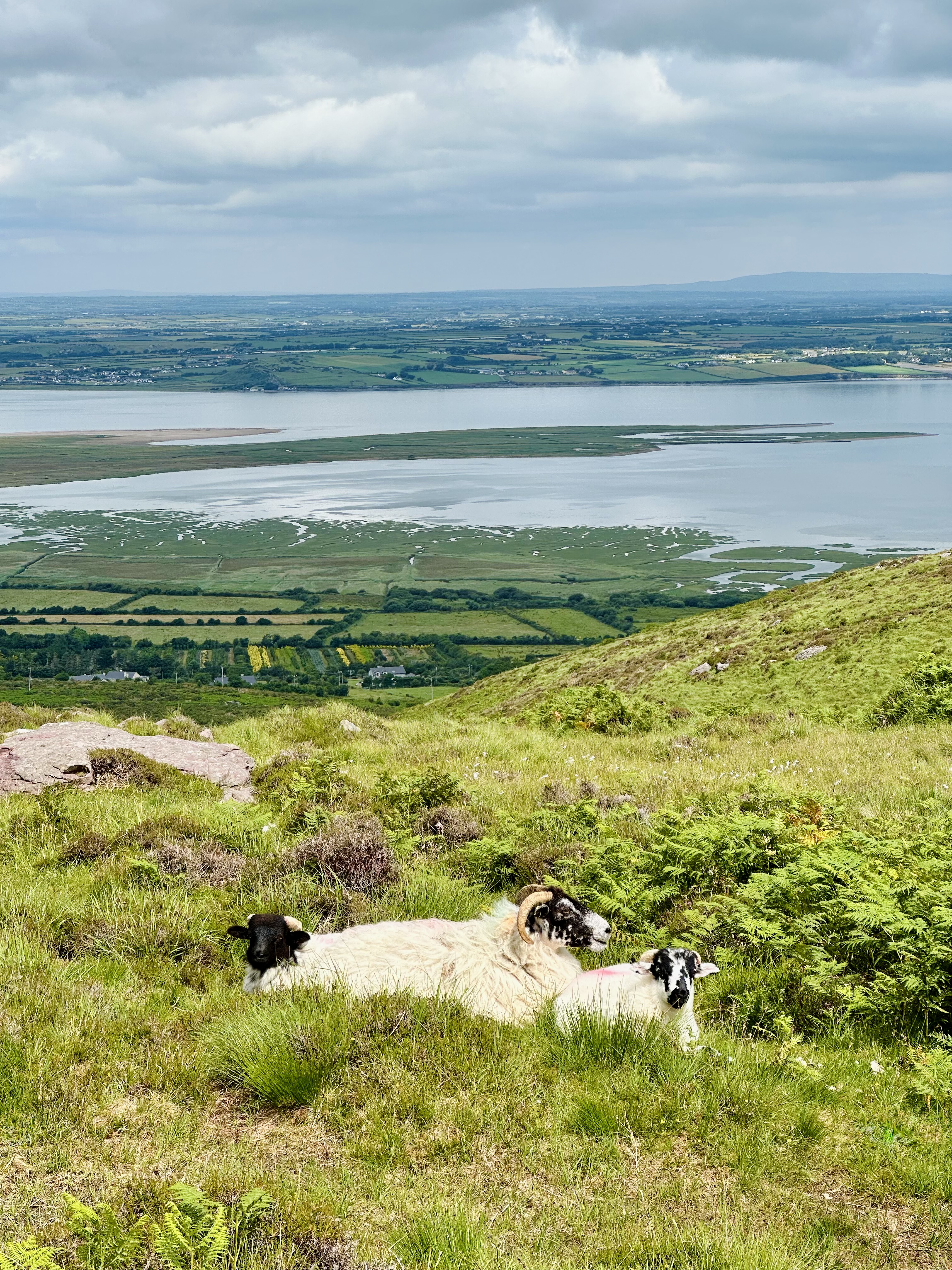
This was about to be the first activation of Knocknagorraveela, the Hill of Midges (or the Hill of Mosquitos, or the Hill of Gravel -- I found these translations in an old Irish newspaper). Whichever translation you pick, it is puzzling, because there were no midges, mosquitos, or gravel anywhere during my hike. In any case, since this was the first activation, obviously no trail had been registered in sotl.as. But the worse thing there were also no trails in the AllTrails app for this hill, and the Hiiker app only had one which did not look curated (the route lines were too straight). I designed my own trail based on satellite imagery. The satellite imagery was deceiving; what I thought was barren rock in the upper parts of the hill turned out to be yellow grass. Along the entire route there are two fences which one needs to cross. But really the only slightly challenging part was the gully at 51.811653, -9.608188. I chose to walk up the stream to avoid the heathers, but next time I'll climb on the heather sligtly to the right of the stream -- the stony brook got very steep in a few spots and I had to scramble there. Once I was past the gully and some tall grass which followed, I walked right (north) along the edge of the pine grove which is visible there on maps and satellite photos. In a few minutes I reached what is called Knocknagorraveela North East from which the views onto the Kenmare River and Iveragh mountains were spectacular.
The saddle stretching west-south from Knocnagorraveela North East is a shallow one and maybe 30-40 minutes later I was on the proper Knocnagorraveela summit. The weather was beautiful. The top is not marked in any way; there's no cairn or trigpoint. The 507-meter summit is technically a part of Caha Mountains, but the main Caha range is south of it, and clearly visible from Knocknagorraveela. My GSM singal was strong. As for the surface, there was only yellow grass and sparse outcrop. I put the antenna up, found myself a spot to sit, and started the radio work. Most of the time I was bathing in sun except for a momentary hailstorm (sic!) which went as fast as it came. Now, while the weather conditions were amazing, the band ones were not. I sat there for 2 hours or so, and had barely made 3 QSOs before I ran out of battery in my KX2. I felt miserable because I thought I hadn't been successful activating the mountain before John EI3KA reminded me via WhatsApp that activation had actually been successful, and that 4 QSOs are needed to score points, not to activate. I had forgotten about that rule, and his message cheered me up a lot!
When walking back through the saddle, I met a man with two kids who were looking for their sheep. I told them where I had seen them, and he was curious about what I was doing. They were the only people I met throughout the entire hike. We chatted for a bit and then I went back to my car. I felt happy and accomplished, even though I didn't score any points. This activation in sunny weather with beatiful views was such a change from the miserable conditions I had the previous couple of times.


